The degree of urbanisation (DEGURBA) is used to classify local administrative units i.e. as 'cities', 'towns and suburbs' or 'rural areas'. This classification is based on the measurement of population density and geographical continuity (neighborhood) in grid cells with a resolution level of 1 km2 (a grid of one square kilometer). Referring to this typology grid cells are grouped into: 'urban centres', 'urban clusters', and 'rural grid cells'.
The three types of local administrative units (LAUs) are defined as follows:
- cities (densely populated areas): LAU level territorial units where at least 50% of the population lives in urban centres;
- towns and suburbs (intermediate density areas): LAU level territorial units where less than 50% of the population lives in 'urban centres' and less than 50% of the population lives in 'rural grid cells';
- rural areas (thinly populated areas): LAU level territorial units where more than 50% of the population lives in 'rural grid cells'.
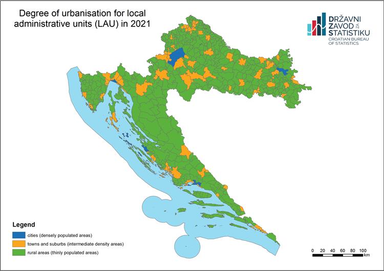
Under this classification, the first two types of local administrative units are collectively referred to as 'urban areas'.
The above-mentioned classification rules may be slightly modified due to the so-called border effect, when clusters defined on the basis of a one-kilometer grid from one unit affect the classification of the neighboring unit. There are two types of such cases. The first occurs when thinly populated local administrative units are adjacent to intermediate density areas or densely populated areas. It may happen then that clusters of areas with medium or high population density cover partially the sparsely populated units, but in such a way that these sparsely populated units become, according to the classification rules, intermediate density areas or densely populated areas. If such units have a total population of less than 5 000 inhabitants and 90% or more of their area is composed of rural grid cells, such units may optionally be reclassified as 'rural areas' ('thinly populated areas'). The second type of border effect occurs when small local administrative units are classified as rural areas due to the mesh size of the population grid (1 km2) being too large when compared with the small size of these LAUs. For this reason, those LAUs with an area of less than 5 km2 and with more than 30% of their surface area covered by non-rural grid cells could optionally be reclassified as 'towns and suburbs' ('intermediate density areas') or 'cities' ('densely populated areas'), according to the respective shares of these clusters included in 'urban centers' or 'urban clusters'.
The degree of urbanisation is being updated with the results of censuses, i.e. after obtaining new data on population density in the 1 km2 grid, as well as in the case of changes in LAU boundaries.
The degree of urbanisation is used as a basis for the functional urban areas, and indirectly it is used for determining metropolitan typology.
Applying the Degree of Urbanisation - a methodological manual